
The 2013 Tournament of Books starts on Monday, and the brackets were announced yesterday. There’s a great tournament diagram available for download, but rather than try to figure out how to fill it in electronically so it was legible, I generated a traditional bracket-style diagram with my picks filled out (at the bottom of the post).
The diagram creation script I wrote last year doesn’t include a pre-round bracket, used this year to decide between Billy Lynn’s Long Halftime Walk (my pick), Fobbit, and Yellow Birds, so I just filled in the obvious (to me!) choice in the top spot of the first round.
The first round presents some challenges for the judges. I’ll be interested in the contest between Bring Up the Bodies and HHhH both of which are historical fiction and were very good. Mantel’s previous book in the story of Thomas Cromwell (Wolf Hall) won the Tournament in 2009, and Bodies is as good as that book. But HHhH is an creative and entertaining mix of semi-fiction, history, and the author’s thoughts and concerns about the story / history he is writing. It’s a different style of book than what is typically in the Tournament (although more traditional that Building Stories, I suppose), and I wonder how it will compete against such an obvious favorite to win.
The Round House vs. The Fault In Our Stars and The Orphan Master’s Son vs. Where’d You Go, Bernedette are contests between excellent books that are completely different in tone and subject (Native American sexual assault and terminal cancer in adolescents / North Korean oppression and madcap antics from a stifled architectural genius). Instead of getting two pairings that are similar in the first round (like Bodies and HHhH) and then two very different books in the second, the different books will be competing against each other initially.
Although Billy Lynn has acheived some literary notariety and is the book I’d like to see win, I think the real heavyweights in the Tournament are Gone Girl and Bring Up the Bodies. I expect to see these two go far, maybe to the final round.
Finally, will there be another book that goes deep into the Tournament that I really didn’t like (like Lightning Rods last year)? I didn’t even try to read Dear Life, couldn’t finish Ivyland, and didn’t enjoy How Should a Person Be? I’m hoping for round one elimination for these books.
Get your diagrams ready and start reading the results on Monday!
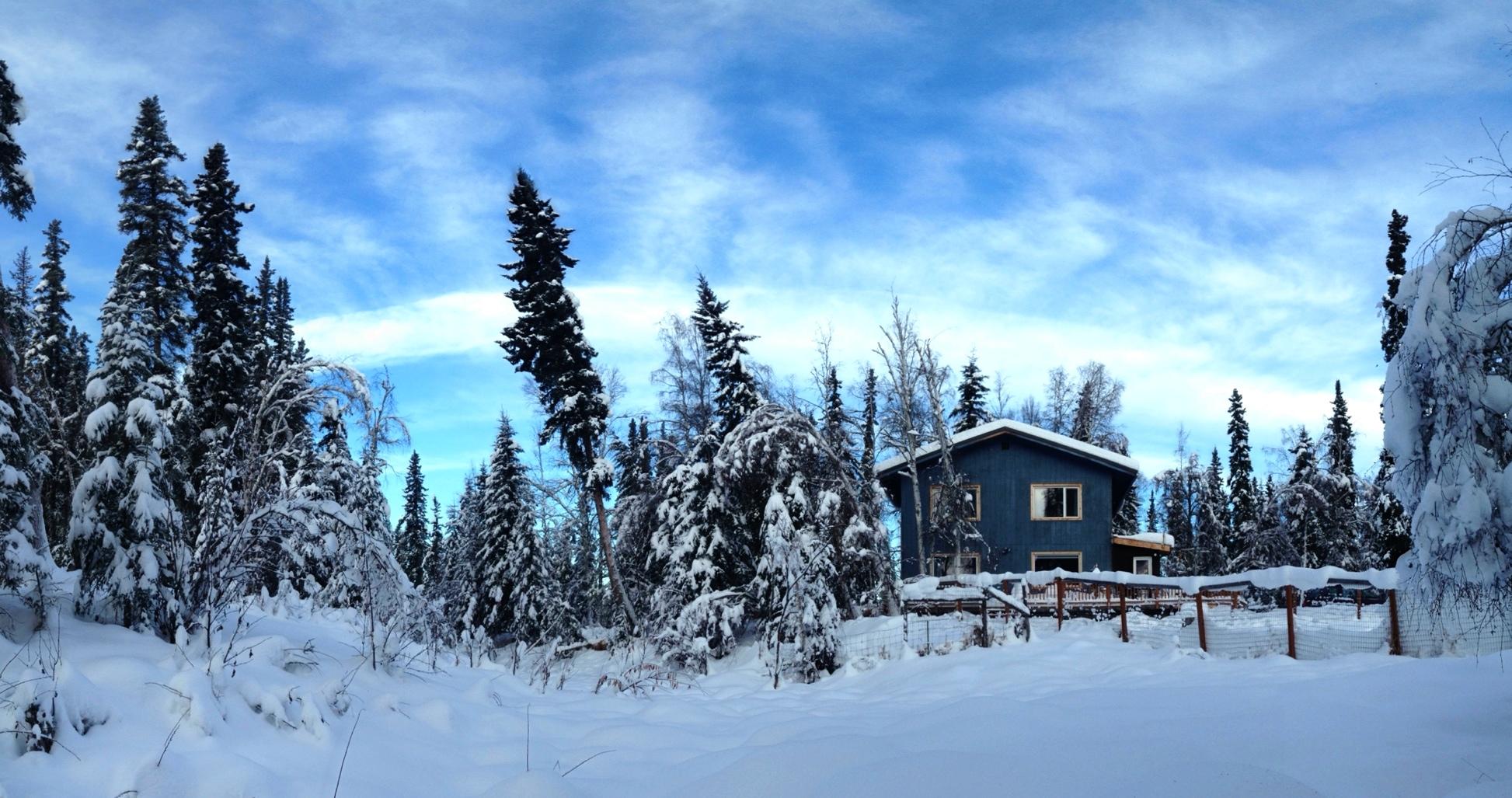
House from the slough
A couple days ago I got an email from a Galoot who was hoping to come north to see the aurora and wondered if March was a good time to come to Fairbanks. I know that March and September are two of my favorite months, but wanted to check to see if my perception of how sunny it is in March was because it really is sunny in March or if it’s because March is the month when winter begins to turn to spring in Fairbanks and it just seems brighter and sunnier, with longer days and white snow on the ground.
I found three sources of data for “cloudiness.” I’ve been parsing the Fairbanks Airport daily climate summary since 2002, and it has a value in it called Average Sky Cover which ranges from 0.0 (completely clear) to 1.0 (completely cloudy). I’ll call this data “pafa.”
The second source is the Global Historical Climatology - Daily for the Fairbanks Airport station. There’s a variable in there named ACMH, which is described as Cloudiness, midnight to midnight (percentage). For the Airport station, this value appears in the database from 1965 through 1997. One reassuring thing about this parameter is that it specifically says it’s from midnight to midnight, so it would include cloudiness when it was dark outside (and the aurora would be visible if it was present). This data set is named “ghcnd.”
The final source is modelled data from the North American Regional Reanalysis. This data set includes TCDC, or total cloud cover (percentage), and is available in three-hour increments over a grid covering North America. I chose the nearest grid point to the Fairbanks Airport and retrieved the daily mean of total cloud cover for the period of the database I have downloaded (1979—2012). In the plots that follow, this is named “narr.”
After reading the data and merging the three data sets together, I generate monthly means of cloud cover (scaled to percentages from 0 to 100) in each of the data sets, in R:
library(plyr)
cloud_cover <- merge(pafa, ghcnd, by = 'date', all = TRUE)
cloud_cover <- merge(cloud_cover, narr, by = 'date', all = TRUE)
cloud_cover$month <- month(cloud_cover$date)

by_month_mean <- ddply(
    subset(cloud_cover,
           select = c('month', 'pafa', 'ghcnd', 'narr')),
   .(month),
   summarise,
   pafa = mean(pafa, na.rm = TRUE),
   ghcnd = mean(ghcnd, na.rm = TRUE),
   narr = mean(narr, na.rm = TRUE))
by_month_mean$mon <- factor(by_month_mean$month,
                            labels = c('jan', 'feb', 'mar',
                                       'apr', 'may', 'jun',
                                       'jul', 'aug', 'sep',
                                       'oct', 'nov', 'dec'))
In order to plot it, I generate text labels for the year range of each data set and melt the data so it can be faceted:
library(lubridate)
library(reshape2)
text_labels <- rbind(
    data.frame(variable = 'pafa',
        str = paste(min(year(pafa$date)), '-', max(year(pafa$date)))),
    data.frame(variable = 'ghcnd',
        str = paste(min(year(ghcnd$date)), '-', max(year(ghcnd$date)))),
    data.frame(variable = 'narr',
        str = paste(min(year(narr$date)), '-', max(year(narr$date)))))

mean_melted <- melt(by_month_mean,
                    id.vars = 'mon',
                    measure.vars = c('pafa', 'ghcnd', 'narr'))
Finally, the plotting:
library(ggplot2)
q <- ggplot(data = mean_melted, aes(x = mon, y = value))
q +
    theme_bw() +
    geom_bar(stat = 'identity', colour = "darkred", fill = "darkorange") +
    facet_wrap(~ variable, ncol = 1) +
    scale_x_discrete(name = "Month") +
    scale_y_continuous(name = "Mean cloud cover") +
    ggtitle('Cloud cover data for Fairbanks Airport Station') +
    geom_text(data = text_labels, aes(x = 'feb', y = 70, label = str), size = 4) +
    geom_text(aes(label = round(value, digits = 1)), vjust = 1.5, size = 3)
The good news for the guy coming to see the northern lights is that March is indeed the least cloudy month in Fairbanks, and all three data sources show similar patterns, although the NARR dataset has September and October as the cloudiest months, and anyone who has lived in Fairbanks knows that August is the rainiest (and probably cloudiest) month. PAFA and GHCND have a late summer pattern that seems more like what I recall.
Another way to slice the data is to get the average number of days in a month with less than 20% cloud cover; a measure of the clearest days. This is a pretty easy calculation:
by_month_less_than_20 <- ddply(
    subset(cloud_cover,
           select = c('month', 'pafa', 'ghcnd', 'narr')),
    .(month),
    summarise,
    pafa = sum(pafa < 20, na.rm = TRUE) / sum(!is.na(pafa)) * 100,
    ghcnd = sum(ghcnd < 20, na.rm = TRUE) / sum(!is.na(ghcnd)) * 100,
    narr = sum(narr < 20, na.rm = TRUE) / sum(!is.na(narr)) * 100);
And the results:
We see the same pattern as in the mean cloudiness plot. March is the month with the greatest number of days with less that 20% cloud cover. Depending on the data set, between 17 and 24 percent of March days are quite clear. In contrast, the summer months rarely see days with no cloud cover. In June and July, the days are long and convection often builds large clouds in the late afternoon, and by August, the rain has started. Just like in the previous plot, NARR has September as the month with the fewest clear days, which doesn’t match my experience.
Over the past couple days in Fairbanks, there has been a strong flow of warm, moist air from the Pacific which culminated in a record (for January 14th) 0.22 inches of precipitation, most of which fell as rain. Nasty. Similar events happened in 2011 and in November 2010, which everyone will remember for the inch or more of ice that glazed the roads for the rest of the winter that year.
The question people always ask after a series of events like this is whether this is a new weather pattern (let’s hope not!) and whether it may be the result of global climate change (which I probably can’t answer).
To look at this, I examined the historical record for Fairbanks, searching for dates that met the following criteria:
- At least six inches of snow on the ground
- During the winter months (October through February)
- Daily high temperature above freezing
- Precipitation falling as rain
The last criteria isn’t part of the historical record, but we can guess the amount of rain by comparing the amount of snow (measured each day on a snow board that is cleared after measurement) with the amount of liquid precipitation gathered in a tube and melted, if necessary. In my experience, the ratio of snow to liquid precipitation is almost always less than 10 to 1 (meaning that 10 inches of snow melts down to less than an inch of liquid), so I’m looking for dates where the precipitation amount is greater than 10 times the snowfall for that date. I’m also estimating the amount of rain by subtracting (snow × 10) from the precipitation total.
Here’s the query:
SELECT dte, tmin_f, tmax_f, prcp_in, snow_in, rain_in,
       row_number() OVER (ORDER BY rain_in desc) AS rank
FROM (
    SELECT to_char(dte, 'YYYY-MM') AS dte, round(avg(tmin_f), 1) AS tmin_f,
           round(avg(tmax_f), 1) AS tmax_f, sum(prcp_in) AS prcp_in,
           sum(snow_in) AS snow_in, sum(rain_in) AS rain_in
    FROM (
        SELECT dte, tmin_f, tmax_f, prcp_in, snow_in, snwd_in,
               round(prcp_in - (snow_in / 10.0), 2) AS rain_in
        FROM get_ghcnd('Fairbanks Intl Ap')
        WHERE extract(month from dte) IN (10, 11, 12, 1, 2)
            AND snwd_in > 6
            AND tmax_f > 32
            AND prcp_in * 10 > snow_in
        ORDER BY dte
    ) AS foo
    GROUP BY to_char(dte, 'YYYY-MM')
) AS bar
ORDER BY dte;
And the results, ordered by the year and month of the event. None of the winter rain events stretched across a month boundary, so it was convenient to aggregate them this way (although 1937 is problematic as I mention below).
| Date | Min Temp (°F) | Max Temp (°F) | Precip (in) | Snow (in) | “Rain” (in) | Rank |
|---|---|---|---|---|---|---|
| 1920-02 | 27.7 | 38.4 | 0.26 | 0.9 | 0.17 | 11 |
| 1931-01 | 12.0 | 33.1 | 0.13 | 0.0 | 0.13 | 12 |
| 1932-02 | 7.0 | 33.1 | 0.77 | 7.1 | 0.06 | 16 |
| 1933-11 | 25.0 | 41.0 | 0.11 | 0.0 | 0.11 | 14 |
| 1935-11 | 30.4 | 37.2 | 1.51 | 3.2 | 1.19 | 2 |
| 1936-11 | 30.0 | 37.0 | 0.44 | 0.0 | 0.44 | 5 |
| 1937-01 | 24.3 | 36.2 | 2.83 | 16.1 | 1.22 | 1 |
| 1941-02 | 28.0 | 42.1 | 0.02 | 0.0 | 0.02 | 23 |
| 1941-11 | -2.9 | 33.1 | 0.20 | 0.9 | 0.11 | 15 |
| 1943-02 | 30.5 | 41.0 | 0.12 | 0.0 | 0.12 | 13 |
| 1944-02 | 21.5 | 36.5 | 0.65 | 2.9 | 0.36 | 7 |
| 1948-01 | 7.0 | 33.1 | 0.01 | 0.0 | 0.01 | 26 |
| 1957-01 | 30.9 | 35.1 | 0.03 | 0.0 | 0.03 | 22 |
| 1961-01 | 17.1 | 33.1 | 0.04 | 0.0 | 0.04 | 20 |
| 1963-01 | 22.5 | 35.1 | 0.56 | 0.7 | 0.49 | 4 |
| 1967-12 | 20.0 | 33.1 | 0.43 | 0.5 | 0.38 | 6 |
| 1970-02 | 10.9 | 43.0 | 0.05 | 0.0 | 0.05 | 17 |
| 1970-10 | 28.0 | 44.1 | 0.04 | 0.0 | 0.04 | 19 |
| 1970-12 | 5.0 | 36.0 | 0.43 | 2.4 | 0.19 | 9 |
| 1986-02 | 10.9 | 37.9 | 0.03 | 0.0 | 0.03 | 21 |
| 1989-02 | 24.1 | 37.0 | 0.40 | 3.8 | 0.02 | 24 |
| 2003-02 | 27.0 | 35.0 | 0.29 | 0.0 | 0.29 | 8 |
| 2006-02 | 17.1 | 42.1 | 0.06 | 0.1 | 0.05 | 18 |
| 2010-11 | 26.1 | 34.3 | 0.95 | 0.1 | 0.94 | 3 |
| 2011-12 | 26.1 | 46.9 | 0.03 | 0.2 | 0.01 | 25 |
| 2013-01 | 24.0 | 37.0 | 0.22 | 0.4 | 0.18 | 10 |
The 2010 event was had the third highest rainfall in the historical record; yesterday’s rain was the tenth highest. The January 1937 event is actually two events, one on the 10th and 11th and one on the 20th and 21st. If we split them up into two events, the 2010 rainfall amount is the second largest amount and the two January 1937 rainfalls come in third and tied for fifth, with November 1935 holding the record.
Grouping the events into decades, we get the following:
| Decade | Rain events |
|---|---|
| 1920s | 1 |
| 1930s | 6 |
| 1940s | 5 |
| 1950s | 1 |
| 1960s | 3 |
| 1970s | 3 |
| 1980s | 2 |
| 1990s | 0 |
| 2000s | 2 |
| 2010s | 3 |
Here’s a visualization of the same data:
I don’t think there’s evidence that what we’ve seen in the last few years is exceptional in the historical record, but it does seem like the frequency of winter rainfall does come in cycles, with a peak in the 30s and 40s, and something of a decline in the 80s and 90s. That we’ve already had three events in this decade, in just over two years, seems like a bad sign to me. I wonder if there are larger scale climatological phenomena that could help to explain the pattern shown here?
Thinking a little more about my previous post on the cold winter we’ve been experiencing for the past three months, it would be easier to understand the analysis if I reported average temperature for the period, rather than a cumulative value. I also realized that if there were missing days in any of the record, that this would skew the results against those years with missing data. So here’s a better query and the results through December 23rd:
SELECT year, round(cum_f / n, 2) AS avg_tempf,
       rank() OVER (ORDER BY cum_f / n) AS rank
FROM (
    SELECT year,
           CASE WHEN year = 2012 THEN round(sum(tavg_f), 2) - 261.5
                ELSE round(sum(tavg_f), 2)
           END AS cum_f,
           CASE WHEN year = 2012 THEN count(*) + 7
                ELSE count(*)
           END AS n
    FROM (
        SELECT extract(year from dte) AS year,
               extract(doy from dte) AS doy,
               (tmin_f + tmax_f) / 2.0 AS tavg_f
        FROM get_ghcnd('Fairbanks Intl Ap')
        ORDER BY year, doy
    ) AS foo
    WHERE doy between extract(doy from '2011-10-01'::date)
                  AND extract(doy from '2012-12-23'::date)
    GROUP BY year
    ORDER BY year
) AS bar
ORDER BY rank;
| Rank | Year | Average temp (°F) | Minimum temp (°F) | Maximum temp (°F) |
|---|---|---|---|---|
| 1 | 1917 | -4.11 | -52 | 57 |
| 2 | 1956 | -3.99 | -50 | 46 |
| 3 | 2012 | -0.74 | -47 | 61 |
| 4 | 1975 | -0.01 | -51 | 57 |
| 5 | 1977 | 0.54 | -52 | 53 |
| 6 | 1942 | 0.92 | -50 | 63 |
| 7 | 1946 | 0.95 | -57 | 55 |
| 8 | 1961 | 1.33 | -54 | 53 |
| 9 | 1996 | 1.75 | -36 | 41 |
| 10 | 1966 | 1.92 | -53 | 61 |
We’ve moved to third place on the list, with an average temperature over the period of less than zero Fahrenheit.
Here’s the same analysis for November and December (through the 23rd):
| Rank | Year | Average temp (°F) | Minimum temp (°F) | Maximum temp (°F) |
|---|---|---|---|---|
| 1 | 1917 | -20.46 | -52 | 21 |
| 2 | 1956 | -16.81 | -50 | 44 |
| 3 | 1946 | -16.34 | -57 | 33 |
| 4 | 1942 | -14.63 | -50 | 21 |
| 5 | 2012 | -14.34 | -47 | 31 |
| 6 | 1977 | -13.86 | -52 | 21 |
| 7 | 1975 | -13.71 | -51 | 30 |
| 8 | 1966 | -10.91 | -53 | 32 |
| 9 | 1906 | -10.72 | -50 | 37 |
| 10 | 1961 | -10.05 | -54 | 42 |
The Weather Service is forecasting some warmer weather starting today, so it’s likely we’ll begin to drop down the list, but it will be interesting to see where we wind up at the end of December.
Regardless, it’s been an exceptionally cold October, November and December in Fairbanks. We’re all just hanging on, hoping our houses, vehicles and other equipment continues to function until we get some warmer weather.
The 2013 Tournament of Books book list came out yesterday: ToB selections
Here they are, with three star rating system for those I've read, ☆ - not worthy, ☆☆ - good, ★★★ - great. I couldn’t finish Ivyland and wasn’t interested in Dear Life at all, so neither of those are contenders for me.
Main tournament:
- HHhH by Laurent Binet ★★★
- The Round House by Louise Erdrich ☆☆
- Gone Girl by Gillian Flynn ★★★
- The Fault in Our Stars by John Green ★★★
- Arcadia by Lauren Groff ☆☆
- How Should a Person Be? by Sheila Heti ☆
- May We Be Forgiven by A.M. Homes ☆☆
- The Orphan Master’s Son by Adam Johnson ★★★
- Ivyland by Miles Klee
- Bring Up the Bodies by Hilary Mantel ★★★
- The Song of Achilles by Madeline Miller ☆☆
- Dear Life by Alice Munro
- Where’d You Go Bernadette by Maria Semple ☆☆
- Beautiful Ruins by Jess Walter ☆☆
- Building Stories by Chris Ware ★★★
- (Winner of the Pre-Tournament Playoff Round, below)
Pre-Tournament Playoff Round:
- Fobbit by David Abrams ☆☆
- Billy Lynn’s Long Halftime Walk by Ben Fountain ★★★
- The Yellow Birds by Kevin Powers
I’ve now read all the main tournament books I’m going to, and two of the “Iraq / Afghanistan” books that are in the Pre-Tournament Playoff. My current pick is Billy Lynn’s Long Halftime Walk, but I wouldn’t be upset if Building Stories, The Fault in Our Stars, Gone Girl, HHhH or Bring Up the Bodies wound up winning. The Orphan Master’s Son is also excellent, but maybe a shade below the other five. Still left to read is the other pre-tournament pick (and the two others I don’t want to waste my time on…).
Updated 2013-01-28